
Case
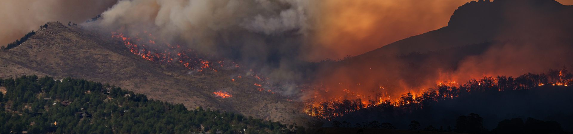
With rapid urbanization encroaching on forested areas, wildfires are becoming a growing concern. News reports of devastating wildfires causing harm to people and the environment have become increasingly common, with the United Nations Environment Programme (UNEP) projecting that the situation will only worsen in the years to come. While wildfires are a natural phenomenon, climate change and global warming are major contributing factors to their increasing threat to human lives and nature. These fires can trigger other catastrophic events, such as fire-induced thunderstorms, lightning strikes, and even human-induced air pollution. As a result, it is essential to implement effective prevention and management strategies, such as having an emergency evacuation management platform that will improve planning and practices, and strengthen firefighting capabilities, all of which will help foster greater resilience within communities.
However, many communities and authorities are ill-prepared without any such emergency management platform to manage such disasters, especially in a country like the USA that has seen an increase in the frequency and severity of wildfires, making it one of the deadliest places for such events. During the summer months, particularly from July to October, the danger of wildfires is so high that it has been designated as the “fire season”. This underscores the urgent need to raise public awareness about wildfires and emergency evacuation procedures that can help mitigate their impact.
In response to this pressing issue, our client, a California-based startup company, has sought to develop a web application to facilitate a fire evacuation management platform. The ultimate objective of this emergency evacuation management platform was to predict the likelihood of wildfires and take appropriate measures to initiate evacuation procedures that establish new standards for first responders and community members in preparing for and navigating through emergency evacuations in the event of a wildfire.
To realize this ambitious undertaking, the client has approached TA to spearhead the development of a cutting-edge fire evacuation management web platform that can revolutionize wildfire response and help keep communities safe.
Challenge
One of the significant challenges faced by our client in developing the fire evacuation management platform was to accurately divide the counties into zones based on natural boundaries, roads, railroads, and other geological features. This was crucial, as an accurate description of what is to the North, South, East and West of each zone's location would aid first responders such as firefighters in taking the necessary actions quickly and evacuating the people to safer locations. Previously, the client used to generate these descriptions manually, which was time-consuming and often resulted in inconsistencies and inaccuracies.
To tackle this issue, Travancore Analytics took on the challenge of developing an algorithm that could automatically generate a precise description of each zone using its coordinates and shape. This innovative approach helped our client to overcome the challenges they faced and streamline their processes, enabling them to provide more efficient emergency response services. The zones will include descriptions in the following format, such as:
- North of <road_name>
- South of <road_name>
- East of <road_name>
- West of <road_name>

Figure 1: An Example of a zone description
Solution
For generating an accurate description of each zone's location, an algorithm was developed that works in such a way that it considers the centroid of the zone to find the major features present in its bounding areas.
As the first step, converting the boundary information to a simpler shape was essential. OpenCV, a popular computer vision library, was used to approximate the shape of the zone. This is necessary because the shape of each zone is unique, varying depending on the factors for which it was created. OpenCV was the ideal tool for this task, as it can handle complex shapes with many vertices and produce a simplified shape that closely approximates the original. Once the shape of the zone has been approximated, the next step is to find the center points on each side of the shape.
To find these center points, we calculated the midpoint of each line segment that makes up the boundary of the zone. Once we have the center points for each side of the shape, the next step is to replace the points with the name of the nearest landmark or road. To do this, we can use a database of landmarks and roads and a simple algorithm that calculates the distance between each point and each landmark or road in the database. The point is then assigned the name of the nearest landmark or road. If no landmark or road is found on the boundary of the zone, the algorithm searches for the nearest landmark to the zone. This is done by calculating the distance between the centroid of the zone and each landmark in the database. The landmark that is closest to the centroid is then assigned to the zone.
Once a particular zone has been selected, the zone boundaries section shows the roads in all four directions of the zone. This is done by calculating the distance between each point on the boundary of the zone and each road in the database. The road that is closest to each point is then assigned to the appropriate direction of the zone.

Figure 7: Screenshot of a zone preview from Alpha version of Zonehaven EVA
Prior to this automation, a county with 200 to 300 zones used to take approximately 1-2 weeks to manually find out the zone boundaries, whereas with the new zone boundary automation algorithm, it takes less than 5 minutes to do the same.
Impact
The impact of this fire evacuation management platform on the safety and well-being of communities during a fire outbreak is significant. The application provides essential information to communities in affected zones, warning them to evacuate or prepare for a fire. With this information, people can quickly assess their surroundings and determine where to take shelter, improving their overall safety during a crisis.
- Improved safety and faster response time
- Get informed faster about emergencies
- Plan and be prepared for incidents
- Communication before, after, and during emergencies becomes easier